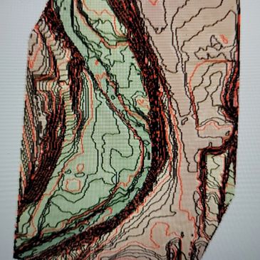
The best service for Aerial LIDAR Topographic and Photogramm

High-Quality LIDAR/Photogrammetry Data
High-Quality LIDAR/Photogrammetry Data
High-Quality LIDAR/Photogrammetry Data
Discount quality Aerial Lidar Topology and Contour Data of Idaho.
Discount quality SLAM Lidar Topology and Contour Data
Discount quality Photogrammetry data topo survey LIDAR topographic map Discount Aerial LIDAR
Our Approach
High-Quality LIDAR/Photogrammetry Data
High-Quality LIDAR/Photogrammetry Data
At PRECISION AERIAL SERVICES, LLC, we take a client-focused approach to our work. We work closely with our clients to understand their needs and provide personalized solutions. Our goal is to exceed our clients' expectations on every project.
WHAT WE DO
We operate UAV LiDAR systems for surveying and engineering companies to increase their efficiency f
We operate UAV LiDAR systems for surveying and engineering companies to increase their efficiency for data collection, and provide higher accuracy data. Our mission is to provide the highest quality data at a cost-effective price.
A UAV LiDAR System can provide massive costs savings purely on the basis of logistics. There are no airports involved, which means no commuting. The ground crew consists of a pilot and an observer, which cuts down on personal costs. And UAVs can stay airborne for 3-4 hours without needing to refuel or land.
This means for things like power line inspections, vegetation studies, and large mapping jobs, UAVs simply cannot be beaten.
The sensor that we utilize will outperform nearly all manned aircraft versions. We are capable of multiple returns with online waveform processing, generating 350,000 points per second.
We have the latest state-of-the-art IMU and GNSS systems that allow us to achieve high accuracies.
Our accuracy is a result of new technology and processing techniques, but also because of our acquisition altitude. Our flights are conducted at altitudes of a couple of hundred feet or less. Less altitude = better accuracy because there is a lower degree of error. By default, all aerial platforms will exhibit a certain level of heading, roll, and pitch error. However, this error has a greater magnitude at higher altitudes. site surveying aerial lidar land surveyor.
lidar topographic map surveying companies topographic surveyor Discount Aerial LIDAR topo survey
UAV services Drone Lidar Surveying Services Drone Lidar Survey Lidar Survey
Fair Mapping Services Pricing

Aerial LiDAR Pricing
Typical* Aerial LiDAR pricing is as follows:
Project Size in Acres Price Per Acre*
Less Than 50 Acres $45/Acre
50 – 150 Acres $40/Acre
151- 249 Acres $35/Acre
250+ Acres $30/Acre
Great budget-friendly UAV services Drone Lidar Surveying Services Drone Lidar Survey Lidar Surveying Survey-grade unmanned aerial lidar Lidar drone survey Lidar drone survey costs Lidar survey drone Lidar drone surveying Lidar drone survey cost Aerial Photogrammetry Drone Photogrammetry 3D Lidar Imaging, 360 Inspection Services construction progress photography construction video volumetric and stockpile reporting
Aerial Photogrammetry
Typical* Aerial Photogrammetry pricing is as follows:
Project Size in Acres Price Per Acre* does not include travel and post-processing
Less Than 50 Acres $55/Acre
50 + Acres $49/Acre
topo survey LIDAR topographic map Discount Aerial LIDAR

*Pricing is for easy access to the project site with ground control points already set up. Additional pricing for inaccessible, difficult terrain, setting control and/or GCP’s, lack of wireless data service, No local RTk Services. Call for further details.
topo survey LIDAR topographic map Discount Aerial LIDAR
Expert Surveying Services
Lidar Drone Mapping Service
Aerial Lidar Mapping Service
Lidar Drone Mapping Service

We provide reliable land surveying services for both commercial and residential properties. Our team of experienced surveyors ensures accurate measurements and precise boundaries, giving you peace of mind.
Lidar UAV Mapping Service
Aerial Lidar Mapping Service
Lidar Drone Mapping Service

Our construction surveying services help ensure that your building project stays on track. From initial measurements to final inspections, we work closely with your team to ensure that your project is completed on time and within budget.
Aerial Lidar Mapping Service
Aerial Lidar Mapping Service
Aerial Lidar Mapping Service

Under Construction volumetric and stockpile reporting Lidar Surveying Services
Topographic Surveying
Topographic Surveying
Aerial Lidar Mapping Service

We provide detailed topographic surveys that identify natural and man-made features of the land. Our surveys are used for a variety of purposes, including engineering, construction, and land-use planning.
Under Construction
Topographic Surveying
Under Construction

Under Construction
Great budget-friendly UAV services Drone Lidar Surveying Services Drone Lidar Survey Lidar Surveying Survey-grade unmanned aerial lidar Lidar drone survey Lidar drone survey costs Lidar survey drone Lidar drone surveying Lidar drone survey cost Aerial Photogrammetry Drone Photogrammetry 3D Lidar Imaging, 360 Inspection Services construction progress photography construction video volumetric and stockpile reporting
Under Construction
Topographic Surveying
Under Construction

Under Construction volumetric and stockpile reporting Lidar Surveying Services
Great budget-friendly UAV services Drone Lidar Surveying Services Drone Lidar Survey Lidar Surveying Survey-grade unmanned aerial lidar Lidar drone survey Lidar drone survey costs Lidar survey drone Lidar drone surveying Lidar drone survey cost Aerial Photogrammetry Drone Photogrammetry 3D Lidar Imaging, 360 Inspection Services construction progress photography construction video
Contact Us
PRECISION AERIAL SERVICES, LLC
Hours
Mon | 09:00 am – 05:00 pm | |
Tue | 09:00 am – 05:00 pm | |
Wed | 09:00 am – 05:00 pm | |
Thu | 09:00 am – 05:00 pm | |
Fri | 09:00 am – 05:00 pm | |
Sat | Closed | |
Sun | Closed |
PRECISION AERIAL SERVICES, LLC
2633 Beech Drive, Evansville, IN 47714
Copyright © 2021 PRECISION AERIAL SERVICES, LLC Indiana Construction Drone, Kentucky Construction Drone, Ohio Construction Drone LIDAR Specialists
All Rights Reserved.